This time Last year we had just a light snow storm but this year that was definitely not the case.
Sandy was a tropical storm that had Meteorologists scrambling to make a difficult and challenging prediction of it's path. Thankfully the weather experts used the best tools they had between the eye in the sky satellites, Dual Pole Radar, Hurricane hunter missions and several conflicting computer models. Even though the Mid Atlantic and Northeast were hit pretty hard we still should thank NOAA , NASA, The National Weather Service and The National Hurricane Center for keeping us very informed that this giant hybrid storm that was aimed at us, All their hard work paid off giving us many days of advanced warning. We need to look back and see if we ever have a storm like this come at us again to see what else we could have done to be better prepared.
+Conditions+&+Forecast+2012-10-29+15-46-55.png)
Back in August of 2011 I walked around and took pictures of the damage that Tropical Storm Irene inflicted nearby. I wrote about it's 10 feet high flood waters around Penny Pack Park and the flood in Hatboro near the creek. Just after my witnessing the damage from that storm I became a Trained Storm Spotter and I am glad I did that. Along with writing for this blog, I have learned about storms and how to be prepared and I am finding ways to keep people in my community informed.
So this time I took this storm (Sandy) very seriously, I read about it's potential storm track and I gradually bought supplies such as canned food, bottled water and lots of batteries. I soon learned that this was a wise choice as I lost power for three days and then left home because of the lack of heat and hot water.
Social media played an important role in passing information about this storm quickly. The pic below was take on the evening of October 29th. I had already lost power for several hours and my cellphone batter was running low on reserve power. I took several pics like this through the storm and posted them online to chronicle the time, temperature, humidity and more dramatically the very low barometric pressure. As the pic shows the pressure was only 949 mb which I believe was lower than what I saw with T.S Irene. I posted my Now cast information as long as I could until my phone battery quit. Later that evening I heard a loud crack and it turned out to be a limb from a tree that fell on top of the a car.
 |
| No Power, no heat on 10/29/12 |
After the Storm
The next day my brother Dan who is a photographer and a fellow Storm Spotter basically called me and said lets drive around and see if we could get some pictures of damage so we did that and went on a quick ride.
Here are a few pictures I took during our leisurely cruise through Montgomery county.
 |
| Dresher PA 10/30/12 Photo by P Saavedra |
 |
| Route 152 - Dresher PA by P. Saavedra |
 |
| Dreshertown Plaza by P. Saavedra |
 |
| Upper Dublin, PA - P. Saavedra |
 |
| Germantown Section of Philly - P.. Saavedra |
 |
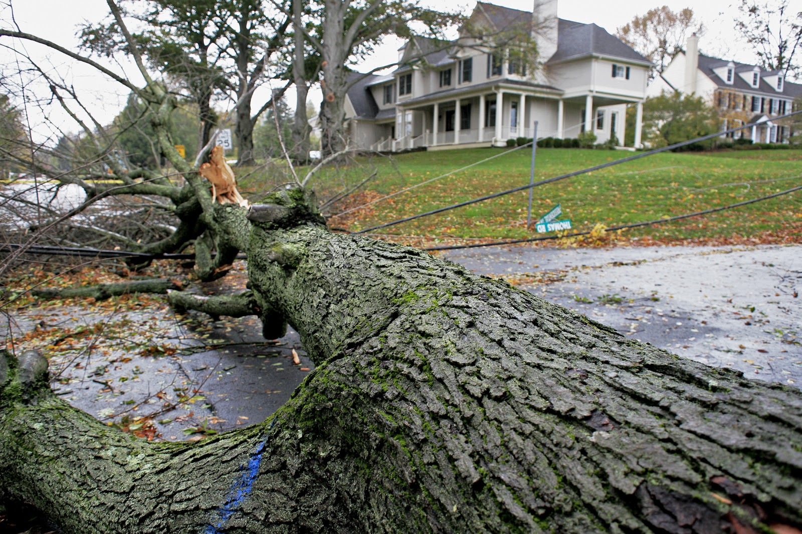
| Whitemarsh, PA - P. Saavedra |
 |
| Whitemarsh PA - P. Saavedra |
 |
| Senton Ave & Butler Pk, P. Saavedra |
 |
| Whitemarsh PA by P. Saavedra |
 |
| Whitemarsh Country Club - P. Saavedra |
 |
| smoke and fire in Wyncote, PA - P. Saavedra |
After experiencing what is the strongest storm that has hit this area in many years, I am glad to say that I do not know of any injuries that has occurred I have to say that the last picture shows a branch that fell right when I was taking that shot and it started a small fire. I am just glad that I was not too close.
Finally I wanted to share a new tool for communicating Weather awareness. The next evolutionary step I had to take was for mobile technology. I wanted to give my readers a gift in the form of a free mobile app. You can download the app for Android.

+Conditions+&+Forecast+2012-10-29+15-46-55.png)


No comments:
Post a Comment
Tell us you thoughts of this story or image..
Thanks!